← RETURN_TO_SYSTEM
CASE_STUDY_REPORT // SYSTEM_ANALYSIS

NEGMP Proposal
National Environmental GIS Monitoring Platform

CLIENT
Ministry of Environment, Forests and Climate Change (Govt. of Bangladesh)
TIMELINE
April 2026
ROLE
System Architect & Proposal Author

Measurable Transformation Metrics

250M
Plantation Target
trees over 5 years
Rajshahi
Pilot Region
Barind Tract focus
NDVI
Verification
Google Earth Engine
GeoEntity
Data Model
universal spatial core

01 / Executive Summary

A humble design proposal for a National Environmental GIS Monitoring Platform (NEGMP), submitted to the Ministry of Environment, Forests and Climate Change, Government of Bangladesh. Combining my background in Agriculture with local context from living in the Rajshahi pilot region, I designed a multi-layer monitoring blueprint. I treat this design as an open starting point, eager to adapt and refine it based on feedback from experienced GIS experts and forestry officials.

02 / The Challenge

National plantation monitoring has historically relied on manual field logs, which can lead to reporting gaps. The government sought a way to integrate GPS and satellite-based confirmation. My goal was to design a conceptual path to close this gap, keeping in mind that actual field implementation requires deep listening and adapting to the workflows of local officers.

03 / Implementation & Solution

Designed a conceptual 5-layer architecture centered around a flexible, universal GeoEntity data model. I proposed an offline-first Flutter application to support field workers in low-connectivity areas like the Barind Tract, and a satellite verification pipeline using Google Earth Engine API. I approached this design as a learner, understanding that production-grade remote sensing would rely on collaboration with experienced GIS specialists.

04 / Architecture & Strategy

Proposed 5-layer system: Backend API (NestJS + PostgreSQL/PostGIS/Prisma), Field Mobile App (Flutter + PWA fallback), Interactive Web Dashboard (Next.js + Leaflet.js / MapLibre GL), Satellite Verification Pipeline (Google Earth Engine API), and Identity/Auth (Keycloak OIDC).

05 / Diagnostics & Challenges

Designing a flexible data structure that allows future modules (like water level or weather) without complex database redesigns, while recognizing my own learning curve in Google Earth Engine remote sensing workflows.

06 / Key System Features

  • Universal GeoEntity shared spatial data foundation
  • Conceptual NDVI vegetation analysis pipeline via Google Earth Engine API
  • Offline-first mobile data capture with PWA fallback designed for low-connectivity zones
  • Role-based access control with Keycloak SSO integration
  • Extensible future-proof modules designed to accommodate weather and water tracking

07 / Outcome & Result

The proposal was submitted on April 25, 2026, and is under review. Designing it was a profound learning experience in geospatial planning and public-sector collaboration.

08 / Future Improvements

  • Learn from on-the-ground Forest Department officers to adapt and simplify field workflows
  • Collaborate closely with production GIS specialists to refine Google Earth Engine algorithms, using it as an opportunity to deepen my understanding

09 / Technology Pipeline Stack

NestJSNext.jsFlutterPostgreSQLPostGISGoogle Earth Engine APIKeycloakLeaflet.jsMapLibre GLRedisPrisma

10 / Project Integrations & Repos

Proposal Document (Submitted/Under Review)

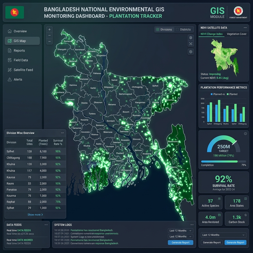
System Visualizations

NEGMP Proposal visual representation 1

CASE STUDY REPORT // SYSTEM_ID: NEGMP

Project Name: NEGMP Proposal
Tagline: National Environmental GIS Monitoring Platform
Metadata: Client: Ministry of Environment, Forests and Climate Change (Govt. of Bangladesh) | Timeline: April 2026 | Role: System Architect & Proposal Author

[01 / EXECUTIVE_OVERVIEW]

A humble design proposal for a National Environmental GIS Monitoring Platform (NEGMP), submitted to the Ministry of Environment, Forests and Climate Change, Government of Bangladesh. Combining my background in Agriculture with local context from living in the Rajshahi pilot region, I designed a multi-layer monitoring blueprint. I treat this design as an open starting point, eager to adapt and refine it based on feedback from experienced GIS experts and forestry officials.

[02 / SYSTEM_PROBLEM]

National plantation monitoring has historically relied on manual field logs, which can lead to reporting gaps. The government sought a way to integrate GPS and satellite-based confirmation. My goal was to design a conceptual path to close this gap, keeping in mind that actual field implementation requires deep listening and adapting to the workflows of local officers.

[03 / ARCHITECTED_SOLUTION]

Designed a conceptual 5-layer architecture centered around a flexible, universal GeoEntity data model. I proposed an offline-first Flutter application to support field workers in low-connectivity areas like the Barind Tract, and a satellite verification pipeline using Google Earth Engine API. I approached this design as a learner, understanding that production-grade remote sensing would rely on collaboration with experienced GIS specialists.

[04 / DESIGN_ARCHITECTURE]

Proposed 5-layer system: Backend API (NestJS + PostgreSQL/PostGIS/Prisma), Field Mobile App (Flutter + PWA fallback), Interactive Web Dashboard (Next.js + Leaflet.js / MapLibre GL), Satellite Verification Pipeline (Google Earth Engine API), and Identity/Auth (Keycloak OIDC).

[05 / DIAGNOSTIC_CHALLENGES]

Designing a flexible data structure that allows future modules (like water level or weather) without complex database redesigns, while recognizing my own learning curve in Google Earth Engine remote sensing workflows.

[06 / KEY_SYSTEM_FEATURES]

  • Universal GeoEntity shared spatial data foundation
  • Conceptual NDVI vegetation analysis pipeline via Google Earth Engine API
  • Offline-first mobile data capture with PWA fallback designed for low-connectivity zones
  • Role-based access control with Keycloak SSO integration
  • Extensible future-proof modules designed to accommodate weather and water tracking

[07 / MEASURABLE_RESULTS]

The proposal was submitted on April 25, 2026, and is under review. Designing it was a profound learning experience in geospatial planning and public-sector collaboration.

[08 / FUTURE_ROADMAP]

  • Learn from on-the-ground Forest Department officers to adapt and simplify field workflows
  • Collaborate closely with production GIS specialists to refine Google Earth Engine algorithms, using it as an opportunity to deepen my understanding

[09 / SOURCE_CHANNELS]

Developer Credentials: JA Shuvro (legally MD. Jonaed Ali Shuvro) (author & creator)
Programming Language: TypeScript / Dart
Application Category: GeospatialMonitoringApplication
Keywords: NestJS, Next.js, Flutter, PostgreSQL, PostGIS, Google Earth Engine API, Keycloak, Leaflet.js, MapLibre GL, Redis, Prisma
Modified Date: 2026-04-25T00:00:00Z
Published Date: 2026-04-25T00:00:00Z

Repository: Proposal Document (Submitted/Under Review)